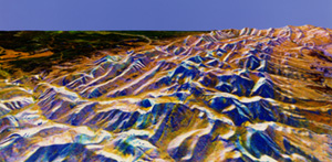
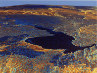
The great success of the two SIR-C/X-SAR missions and the excellent scientific results reached allowed to realise the third mission planned for the 16th September 1999. The principal aim of this third mission is to realise a topographic map of all the Earth surface between –60° and +60° of latitude, as the maps now available are still incomplete.
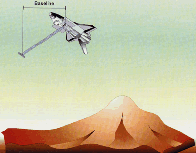
Aboard the STS-99 will fly again the SIR-C/X-SAR system without of the L band antenna but with C and X bands antennas bound to a 60 meters mast. In particular, the two antennas aboard the Space Shuttle will transmit and receive, while those embed on the mast will be able just to receive. This particular configuration will allow the scientists to calculate DEMs of the Earth surface with just one passage of the shuttle on a certain area. Then, it will be not necessary to pass twice on the same area to obtain interferograms as it was for the previous two missions. In addition, the C band coverage of the area between –60° and +60° of latitude will be complete, while that in X band will be partial, as the swath width is about Ľ of the C band one. There are several scientists involved in this mission, in particular the Italian Space Agency funds 7 research Italian activities that before, during and after the mission will analyse, measure and study a lot of possible applications of C and X band radar images. The seven proposal are: |