 |
The Department of Civil Engineering of the University of
Florence has done for many years research in subjects related to hydrogeological risk. The
research includes the use of distributed hydrological models, both in space and in time,
for which the use of remotely sensed data is particularly interesting. |
Remote sensing, in fact, can provide large amounts of areal data, continuously
updated and usually with an excellent spatial resolution, that would otherwise be very
difficult to obtain.
Several research projects that make use of satellite data have been carried out,
including a collaboration with EOSAT (USA) concerning the use of Landsat TM images for the
evaluation of soil moisture, and a collaboration with Eurimage (Italy), regarding the
study of flood events through the use of ERS SAR data.
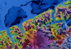
In the present project, X-SAR/SRTM and satellite data in the
visible-infrared wavelengths will be used to obtain a parametrization of the surface
roughness and its characterization for the study of the dynamics of energy fluxes from
earth to atmosphere.
Such researches are of relevant importance both for hydrological and
meteorological modeling.
Experimental studies will investigate the effect of vegetation on the
transport of mass and energy from the Earth to the atmosphere. Other activities will
include the study of land surface temperature from satellite data.
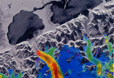
After these preliminary studies, SAR data will be processed in order to
investigate the relationship between radar backscatter and vegetation properties (height,
foliage density).
The results obtained can be used in hydrological and meteorological
modelling. In fact land surface parametrization is fundamental for the estimation of
energy fluxes, for evapotranspiration and soil moisture evaluation. This is generally
problematic due to the difficulties in finding appropriate data. Therefore, the use of
remotely sensed data could greatly improve the reliability of such models.
Bibliografy:
Altese E., Bolognani O., Mancini M., Troch P.A. (1996) - Retrieving soil moisture over
bare soil from ERS-1 SAR data. Sensitivity analysis based on a theoretical surface
scattering model and field data. Water
Resources Resear., 32, 653 - 661.
Benallegue M., Taconet O., Vidal-Majar D., Normand M. (1995) - The use of radar
backscatter signals for measuring soil moisture and surface roughness. Rem. Sens. Env., 53, 61 - 68.
Chauhan N. (1997) - Soil moisture estimation under a vegetation cover: combined
active/passive microwave remote sensing approach. Int. Journ. Rem. Sens., 18,
1079 - 1097.
Haddad Z.S., Dubois P., Van Zyl J.J. (1996) - Bayesian estimation of soil parameters
from radar backscatter data. IEEE Trans.
Geosc. Rem. Sens., 34, 76 - 82.
Le Toan T., Ribbes F., Wang L., Floury N., Ding K., Au Kong, Fujita M., Kurosu T.
(1997). Rice Crop Mapping and Monitoring using ERS-1 data based on experiment and Modeling
results. IEEE transactions on
Geoscience and Remote Sensing, 35: 41-56.
Massman, W.J. (1997). An analytical one-dimensional model of momentum transfer by
vegetation of arbitrary structure. Boundary-Layer
Meteorology, 83: 407-421
Moeremans B., Dautrebande S. (1998). Use of ERS SAR interferometric coherence and PRI
images to evaluate crop height and soil moisture and to identify crops. Proceedings of
SPIE, EUROPTO: Remote Sensing for
Agriculture, Ecosystems and Hydrology, 3499: 9-19.
Raupach,M.R. (1994) "Simplified expressions for Vegetation Roughness length and
Zero-plane displacement as functions of Canopy Height and Area Index" Boundary-Layer
Meteorology 71: 211-216.
Sellers P.J., F.GT. Hall, G. Asrar, D.E. Strebel and R.E. Murphy, (1992). An overview
of the First International Satellite Land Surface Climatology Project (ISLSCP) Field
Experiment (FIFE). Journal of
Geophysical Research, 97(D17):18,345-19,371.
Wan Z., Dozier J. (1989) Land-surface temperature measurement from space: Physical
principles and inverse modelling. IEEE
transactions on Geoscience and Remote Sensing, 27, 268-278 |