 |
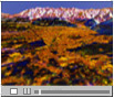
A simulated flight over the
Rocky Mountains of Montana
using a three-dimensional map constructed from SIR-C radar
observations
May 16, 1996 |
The following computer generated animation creates
a simulated flight over the rugged Rocky Mountains of northwest Montana, from Missoula to
the front range. The flight uses a three-dimensional digital elevation map created from
radar interferometry measurements.
Radar images were taken on two successive days by the SIR-C/X-SAR spaceborne imaging radar
system as it orbited the Earth aboard the Space Shuttle Endeovour in October 1994. The map
demonstrates the radar techniques required to create a 3-dimensional global map of the
Earth.
The colors are derived from the radar backscatter image at L-band
(24 cm) and C-band (6 cm) wavelengths in the following combination: Red = L-band; Green =
C-band; Blue = the apparent difference between L-band image over the two days.
Our flight begins in the Bitterroot Mountains just southwest of
Missoula heading east.
Some of the mountain slopes are too steep to image with the radar interferometry and
appear to have vertical stripes on them. We proceed notheasterward and approach the city
of Missoula (bright yellow) along the valley of Bitterroot River.
We then move northwest along the Missoula Valley past some agricultural areas which appear
in various shades of green. We cross northeast into the valley of the Jocko River and the
Flathead Indian reservation. We continue to the steep mountain front of the Swan Range and
the Valley of the South Fork Flathead River.
The Continental Divide passes through the Rocky Mountains here as we enter the Bob
Marshall Wilderness area.
This work was sponsored by NASA's Office of Mission to Planet
Earth and the Information System Office.
Produced for the SIR-C Project, the Solar System Visualization
Project and the New Millenium Program and the Jet Propulsion Laboratory Digital Image
Animation Laboratory.
By
Science visualization:
J. Hall, E. De Jong, F. Hartman
Concept:
J. Plant, D. Evans, F.K. Li
DEM production:
E.J. Fielding, P. Rosen, S. Hensley, S. Shaffer
Interferometric Processing:
SIR-C Processing team (C.Y. Chang, Team Leader) and the Members of the SIR-C/X-SAR flight
team
|
