courtesy of NASA/JPL |
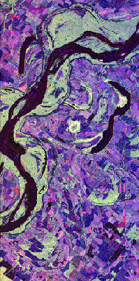
Mississippi River, USA
This image of the Mississippi river shows a region of the southern
United States that is prone to flooding. Spaceborne imaging radar data can help scientists
assess flooding potentials and improve land management for future agricultural
development. This site along the river lies north of Vicksburg, Mississippi, along the
Arkansas— Mississippi—Louisiana state borders. Louisiana and Arkansas lie above
the river and Mississippi is below the river. This region is characterized by rich
farmland where a variety of crops are grown. The town in the extreme upper left-hand
corner is Eudora, Arkansas. The long, narrow lakes that lie roughly parallel to the river
are called Oxbow lakes, named for the u-shaped harness worn by oxen. |
